
Connecting Surat and Chennai with a single continuous expressway means drawing a line across the western and southern peninsular map of India through six states, dozens of industrial corridors, and the agricultural heartlands that feed much of the country. That ambition has been through at least one significant revision — in December 2025, the Ministry of Road Transport and Highways confirmed that the original Surat-to-Nashik section has been dropped from the project due to persistent land acquisition difficulties and prolonged environmental approval delays on that northern stretch. The expressway will now run from Nashik southward to Chennai — approximately 900 kilometres rather than the originally planned 1,271 kilometres.
The decision to trim the northern portion was a practical one. The Nashik-to-Surat stretch had stalled while southern sections in Karnataka — particularly the Akkalkot-to-Yadgir packages — had actually raced ahead and been completed in December 2025, a full year before the original overall deadline. Rather than hold the functional southern corridor hostage to the troubled northern section, MSRDC will separately develop a greenfield expressway connecting Nashik to the Samruddhi Mahamarg’s Bharvir Khurd junction, preserving the traffic movement function of the scrapped stretch through a different alignment.
Current Status: Under Construction. Karnataka sections largely complete. Maharashtra and other sections at varying progress stages. Full completion expected by end of fiscal year 2027. Surat-to-Nashik section removed from project scope as of December 2025. Revised length approximately 900 km from Nashik to Chennai.
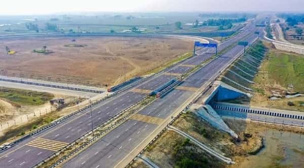
Surat Chennai Expressway Overview
| Detail | Information |
| Name | Nashik-Chennai Expressway (revised name reflecting route change) / Surat-Chennai Expressway |
| Current Status | Under Construction — Karnataka sections complete; others progressing |
| Revised Route | Nashik, Maharashtra → Chennai, Tamil Nadu (Surat-Nashik section dropped Dec 2025) |
| Original Route | Surat, Gujarat → Chennai, Tamil Nadu |
| Revised Length | Approx. 900 km (down from 1,271 km) |
| States Covered | Maharashtra, Karnataka, Telangana, Andhra Pradesh, Tamil Nadu |
| Key Cities Along Route | Nashik, Ahmednagar, Solapur, Kalaburagi, Raichur, Kurnool, Kadapa, Tirupati, Chennai |
| Lanes | 6 lanes (access-controlled) |
| Speed Limit | 120 km/h (design speed) |
| Toll Fee | Not yet notified — expressway not operational |
| Full Completion Expected | End of FY 2027 |
| Project Cost (Revised) | Lower than original ₹45,000–50,000 crore estimate — revised figures pending |
| Governing Authority | NHAI under Bharatmala Pariyojana Phase II |
| Alignment Type | Mix of greenfield and brownfield |
| Travel Time After Completion | Nashik to Chennai approx. 18 hours (versus 30+ hours currently) |
Route and Location
The original alignment ran from Surat through Nashik, Ahmednagar, Solapur, Kalaburagi, Raichur, Kurnool, Kadapa, Tirupati, and Chennai. With the northern section removed, the revised corridor effectively begins at Nashik and follows the same southern alignment through Maharashtra, Karnataka, Telangana, Andhra Pradesh, and Tamil Nadu.
The Karnataka portion has progressed furthest — the Akkalkot-to-Yadgir section and the Baswantpur-to-Singnodi packages are complete or near-complete. The Maharashtra packages from Nashik southward through Ahmednagar and Solapur are at varying construction stages, while the Andhra Pradesh and Tamil Nadu brownfield upgrade sections are in active construction.
Speed Limits and Toll
The expressway is designed for 120 km/h and will be access-controlled throughout its alignment. Toll fees have not been officially notified as no section has been opened to public traffic yet. Once operational, the toll structure will follow NHAI’s standard per-kilometre Bharatmala expressway pricing model. Individual section tolls will be notified progressively as packages complete and open.
Nearby Areas
Nashik: The Maharashtra entry point is one of India’s most important wine-producing and agricultural trade cities, whose improved connectivity toward southern India opens significant export logistics possibilities. Kalaburagi and Raichur: Two of Karnataka’s most important northern district cities in the Hyderabad-Karnataka region, whose economic development has historically lagged behind coastal Karnataka — the expressway’s passage through this belt is expected to significantly improve their industrial and agricultural market access. Tirupati: The world’s most visited pilgrimage site is accessible from the expressway’s Andhra Pradesh section near its southern end, adding an enormous religious tourism dimension to the corridor’s daily traffic character.
Frequently Asked Questions (FAQs)
Q1. Is the Surat Chennai Expressway open?
A: No — it is under construction. Karnataka packages are largely complete but no section has opened to public traffic. Full completion expected FY 2027.
Q2. What is the revised length of Surat Chennai Expressway?
A: Approximately 900 km. The Surat-to-Nashik section was dropped in December 2025 due to land acquisition issues. The corridor now runs from Nashik to Chennai.
Q3. What is the speed limit on Surat Chennai Expressway?
A: 120 km/h — India’s standard premium access-controlled expressway speed.
Q4. What is the toll fee on Surat Chennai Expressway?
A: Not yet notified. Toll rates will be announced when individual sections open to public traffic.
Q5. Which states does the revised Surat Chennai Expressway pass through?
A: Maharashtra, Karnataka, Telangana, Andhra Pradesh, and Tamil Nadu — five states from the Nashik terminus to Chennai.