
The Atal Setu opened on January 12, 2024 and immediately redefined how South Mumbai connects to Navi Mumbai. India’s longest sea bridge — 18.2 kilometres spanning Thane Creek from Sewri in South Mumbai to Chirle near Nhava Sheva — reduced the South Mumbai-to-Navi Mumbai crossing from 45 minutes to under 20. But from Chirle, a gap remained. Reaching the Mumbai-Pune Expressway still required navigating the congested internal roads of Navi Mumbai and the perennially bottlenecked Panvel area — adding 45 to 90 minutes to what should have been a seamless onward journey toward Pune, Goa, and the rest of western and southern India.
The Chirle-to-Mumbai-Pune Expressway Elevated Corridor addresses exactly this gap. The 7.35-kilometre, six-lane elevated connector, being built by MMRDA at a cost of ₹1,100 crore, runs through Chirle and Palaspe in Navi Mumbai, directly linking the Atal Setu’s Chirle terminus to the Mumbai-Pune Expressway (NH-48) via a signal-free elevated corridor. The project was updated as of April 2026 with MMRDA confirming an on-schedule completion target of February 2027.
The corridor comprises two distinct elevated sections — a 4.96-kilometre section from Chirle to Gavhan Phata in Ulwe and a 1.7-kilometre section from Palaspe to Kon village near Panvel. Two elevated interchanges at Chirle and Palaspe will integrate the corridor into the JNPT Highway, completing the connectivity chain. Construction progress as of late 2025 shows active girder launching on ramps, pier casting, and piling underway at multiple locations. MMRDA Metropolitan Commissioner Sanjay Mukherjee confirmed the project is on schedule.
When complete, the corridor will reduce South Mumbai-to-Pune travel time by 60 to 90 minutes compared to the current Atal Setu route, which still requires Navi Mumbai road navigation. Union Minister Nitin Gadkari has spoken of a 14-lane road near Atal Setu eventually reducing Mumbai-Pune Expressway traffic by 50 percent — the Chirle connector is the initial phase of this broader vision.
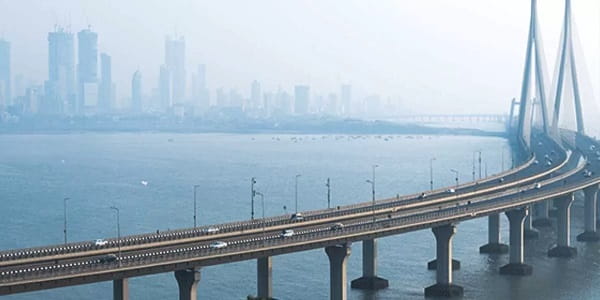
Chirle to Mumbai-Pune Expressway Overview
| Detail | Information |
| Name | Chirle to Mumbai-Pune Expressway Elevated Corridor (Atal Setu–MPEW Connector) |
| Developer | MMRDA (Mumbai Metropolitan Region Development Authority) |
| Length | 7.35 km (two elevated sections) |
| Section 1 | Chirle to Gavhan Phata, Ulwe — 4.96 km elevated |
| Section 2 | Palaspe to Kon village, Panvel — 1.7 km elevated |
| Lanes | 6-lane |
| Project Cost | ₹1,100 crore |
| Contractor | Gawhar Constructions Limited |
| Completion Target | February 2027 |
| Status (Nov 2025) | Active construction — girder launching, pier casting in progress |
| Connects | Atal Setu (Chirle terminus) → JNPT Highway → Mumbai-Pune Expressway (NH-48) |
| Interchanges | Two elevated interchanges at Chirle and Palaspe |
| Travel Time Saving | 60–90 minutes reduction vs current Atal Setu to MPEW route |
| Strategic Location | Adjacent to Navi Mumbai International Airport (under construction at Chirle) |
| Atal Setu | 18.2 km sea bridge (Sewri–Chirle); opened January 12, 2024; ₹17,843 crore |
| Highways Connected | NH-348 (JNPT Highway) and NH-48 (Mumbai-Pune Expressway) |
Route and Location
The elevated corridor begins at the Chirle interchange — where the Atal Setu terminates on the Navi Mumbai side — and runs northeastward through Chirle and Palaspe in Uran taluka, crossing NH-348 (the JNPT Highway) before connecting to the NH-48 Mumbai-Pune Expressway near Panvel. The Chirle node is also the site of the Navi Mumbai International Airport under construction, making the corridor a critical multi-infrastructure junction for the entire region.
Connectivity
The full connectivity chain once the corridor opens will be: South Mumbai (Sewri) → Atal Setu (18.2 km) → Chirle → Elevated Corridor (7.35 km) → Mumbai-Pune Expressway (94.5 km) → Pune. This means a traveller from South Mumbai to Pune will never need to touch a ground-level Navi Mumbai road signal. The JNPT port connectivity via NH-348 adds a significant freight logistics dimension, giving containers from Nhava Sheva Port a faster access route to the expressway network.
Nearby Areas
Navi Mumbai International Airport — under construction at Chirle, expected to be one of India’s largest airports when operational — is the primary strategic neighbour of this corridor. JNPT (Jawaharlal Nehru Port) — India’s largest container port — is accessible via NH-348, which the elevated corridor crosses. The NAINA (Navi Mumbai Airport Notified Influenced Area) development zone is expected to benefit significantly from the improved connectivity this corridor provides.
Frequently Asked Questions (FAQs)
Q1. What is the Chirle to Mumbai-Pune Expressway corridor?
A: A 7.35 km, six-lane elevated connector being built by MMRDA at ₹1,100 crore, linking the Atal Setu’s Chirle terminus directly to the Mumbai-Pune Expressway (NH-48) via Navi Mumbai.
Q2. When will the Chirle to Mumbai-Pune Expressway corridor open?
A: February 2027 — confirmed on-schedule by MMRDA as of April 2026.
Q3. How much travel time will this corridor save?
A: 60 to 90 minutes for travelers from South Mumbai to Pune, by eliminating the need to navigate Navi Mumbai’s internal roads and Panvel’s traffic congestion.
Q4. What is the Atal Setu that connects to this corridor?
A: The Atal Bihari Vajpayee Sewri-Nhava Sheva Atal Setu — India’s longest sea bridge at 18.2 km, connecting Sewri in South Mumbai to Chirle in Navi Mumbai. Opened January 12, 2024 at ₹17,843 crore.
Q5. What airport is located near the Chirle end of this corridor?
A: Navi Mumbai International Airport — currently under construction at Chirle. Its proximity makes this corridor a critical access road for the future airport and positions Chirle as one of the most significant transit nodes in the Mumbai Metropolitan Region.