
Uttar Pradesh already holds the distinction of having more operational expressways than any other Indian state. The Agra-Lucknow, Purvanchal, Ganga, Bundelkhand, and Gorakhpur Link Expressways have progressively stitched together large sections of the state’s north-south and east-west mobility. But one structural gap remains: there is no direct high-speed east-west corridor linking western UP’s border with Haryana to eastern UP’s border with Bihar. The Gorakhpur-Shamli Expressway, when built, will fill that gap with the state’s longest ever expressway — and one of its most strategically significant.
The proposed Gorakhpur-Shamli Expressway is a 700 to 750-kilometre, six-lane greenfield access-controlled corridor under the Bharatmala Pariyojana connecting Shamli district at the Haryana border in western UP to Gorakhpur (and extending to Kushinagar near the Bihar and Nepal border) in eastern UP. NHAI has been appointed to construct it and, as of December 2025, the Detailed Project Report (DPR) was reported complete — the critical technical document that precedes land acquisition and construction tendering. Land acquisition is expected to begin through 2025-26, construction start from 2026, and completion targeted between 2028 and 2029.
The expressway will pass through 22 districts and 37 tehsils of Uttar Pradesh, including Shamli, Muzaffarnagar, Saharanpur, Bijnor, Moradabad, Rampur, Bareilly, Pilibhit, Shahjahanpur, Sitapur, Bahraich, Shravasti, Balrampur, Sant Kabir Nagar, Gorakhpur, and Kushinagar. The alignment also runs close to the India-Nepal border — a strategic dimension beyond civilian mobility. The current Gorakhpur-to-Shamli journey through Delhi takes over 12 hours. This expressway will reduce it to approximately 6 hours and cut the distance by around 200 kilometres. An emergency airstrip for jet landings is also planned along the corridor.
Estimated project cost is approximately ₹40,000 crore. One of the expressway’s distinctive sustainability features is that solar power is planned to meet all its operational energy needs. It will be UP’s third-largest greenfield corridor and, upon completion, the state’s longest expressway — surpassing the Ganga Expressway’s 570 kilometres from Meerut to Prayagraj.
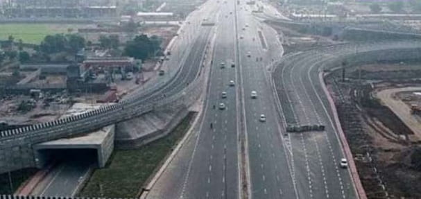
Gorakhpur Shamli Expressway Overview
| Detail | Information |
| Name | Gorakhpur-Shamli Expressway |
| Maintained By | NHAI |
| Length | 700–750 km |
| Lanes | 6-lane access-controlled greenfield |
| West End | Shamli, UP–Haryana Border |
| East End | Gorakhpur / Kushinagar, UP–Bihar/Nepal Border |
| State | Uttar Pradesh |
| Programme | Bharatmala Pariyojana |
| Estimated Cost | Approx. ₹40,000 crore |
| DPR Status | Completed — December 2025 |
| Land Acquisition | Expected 2025–26 |
| Construction Start | Expected 2026 |
| Completion Target | 2028–2029 |
| Districts Covered | 22 districts, 37 tehsils |
| Travel Time Reduction | 12+ hours to ~6 hours (Gorakhpur–Shamli) |
| Distance Saving | ~200 km shorter than current route via Delhi |
| UP Rank | Longest expressway in UP on completion |
| Special Feature | Emergency airstrip for jets; solar-powered operations |
| Nepal Border | Alignment runs close to India-Nepal border |
Route and Location
The expressway originates near Shamli at the Haryana border and runs eastward through Muzaffarnagar, Saharanpur, Bijnor, and Moradabad before passing through the Bareilly and Pilibhit Terai zone, crossing Sitapur, and moving through Bahraich toward the Nepal border territory near Shravasti and Balrampur before entering Gorakhpur division and terminating at Kushinagar. The alignment broadly follows the northern UP belt — the fertile Terai and Rohilkhand plains — making it the first high-speed expressway to directly connect this agriculturally rich but infrastructure-poor northern zone.
Connectivity
At Shamli, the expressway connects to the Delhi-Dehradun Expressway spur (Ambala-Shamli Expressway, 121 km) — creating a chain from the Haryana-Punjab corridor southward to Gorakhpur without touching Delhi. At the eastern end, connection to the Gorakhpur Link Expressway provides onward access to the Purvanchal Expressway and the Lucknow-Delhi chain.
Nearby Areas
Bareilly — the commercial and manufacturing city of the Rohilkhand belt, known for furniture, surmai fish, and as a significant UP metropolitan center — lies mid-route. Bahraich’s Katarniaghat Wildlife Sanctuary — one of India’s finest tiger and gharial conservation zones on the Girwa River — is in the expressway’s northern Terai zone. Kushinagar, where the Buddha attained Mahaparinirvana, is the sacred eastern terminus city — the expressway will significantly improve Buddhist circuit access from western India.
Frequently Asked Questions (FAQs)
Q1. What is the Gorakhpur Shamli Expressway?
A: A proposed 700 to 750 km, six-lane greenfield expressway under Bharatmala connecting Shamli (western UP) to Gorakhpur/Kushinagar (eastern UP) through 22 districts. Estimated cost ₹40,000 crore.
Q2. What is the current status of Gorakhpur Shamli Expressway?
A: DPR completed December 2025. Land acquisition expected 2025-26, construction start 2026, completion targeted 2028-2029.
Q3. How much travel time will the Gorakhpur Shamli Expressway save?
A: It will reduce the Gorakhpur-Shamli journey from 12+ hours to approximately 6 hours and cut the distance by about 200 km by eliminating the current Delhi detour.
Q4. What is special about the Gorakhpur Shamli Expressway’s design?
A: An emergency airstrip for jets is planned along the corridor, and all operational energy needs will be met through solar power.
Q5. Will the Gorakhpur Shamli Expressway become UP’s longest expressway?
A: Yes — at 700 to 750 km it will surpass the Ganga Expressway (570 km) as UP’s longest expressway upon completion.