
The Terai is a specific landscape. The narrow belt of flat, forested, and river-dissected land running along the sub-Himalayan foothills from Nepal’s border southward into UP, Bihar, and into the northeastern states has for centuries been among India’s most agriculturally productive zones — but also among its most infrastructurally underserved. Rivers that swell catastrophically during monsoon — the Gandak, the Bagmati, the Kosi — have historically made road construction expensive and disrupted the connectivity that every other region takes for granted. The Gorakhpur-Siliguri Expressway is the most ambitious single infrastructure response to the Terai’s connectivity deficit that India has ever planned.
The Government of India approved the construction of the Gorakhpur-Siliguri Expressway — a 519 to 568-kilometre, six-lane greenfield access-controlled expressway connecting Gorakhpur in Uttar Pradesh to Siliguri in West Bengal through the heart of Bihar’s Terai and Mithila zones. Total project cost is estimated at approximately ₹38,645 crore, with Bihar contributing the largest share at approximately ₹27,552 crore — reflecting that the overwhelming majority of the expressway, approximately 416 kilometres, passes through Bihar. Uttar Pradesh accounts for approximately 84 kilometres and West Bengal for approximately 19 kilometres.
The expressway passes through eight districts of Bihar — West Champaran, East Champaran, Sheohar, Sitamarhi, Madhubani, Supaul, Araria, and Kishanganj — and 313 villages across 39 blocks. It will have a maximum speed limit of 120 kilometres per hour and is being constructed in the EPC model. Bridges over the Gandak, Bagmati, and Kosi rivers are among the project’s most technically demanding components. Route alignment has been recently revised in areas including Kishanganj to pass through Thakurganj, addressing local demands. The target completion date is 2028, with land acquisition in final stages and DPR near completion as of 2025.
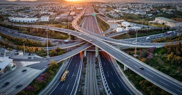
Gorakhpur Siliguri Expressway Overview
| Detail | Information |
| Name | Gorakhpur-Siliguri Expressway |
| Maintained By | NHAI |
| Length | 519–568 km |
| Lanes | 4-lane (expandable to 6-lane) |
| From (West) | Gorakhpur, Uttar Pradesh (Gorakhpur Ring Road / NH-27) |
| To (East) | Siliguri, West Bengal (Darjeeling District) |
| States Covered | Uttar Pradesh (84.3 km), Bihar (416.2 km), West Bengal (18.97 km) |
| Bihar Districts | West Champaran, East Champaran, Sheohar, Sitamarhi, Madhubani, Supaul, Araria, Kishanganj |
| Key Cities | Gorakhpur, Bettiah, Motihari, Sitamarhi, Darbhanga, Supaul, Kishanganj, Islampur, Bagdogra, Siliguri |
| Estimated Cost | ₹38,645 crore (Bihar: ₹27,552 crore) |
| Construction Model | EPC (Engineering, Procurement, Construction) |
| Speed Limit | 120 km/h |
| Target Completion | 2028 |
| Current Status | Approved; DPR near completion; land acquisition in final stages (2025) |
| Key Bridges | Over Gandak, Bagmati, and Kosi rivers |
| Villages Covered | 313 villages across 39 blocks in Bihar |
| Strategic Importance | Nepal border connectivity; Northeast India gateway |
Route and Location
The expressway starts from the Gorakhpur Ring Road junction at NH-27 and runs eastward through the flatlands of Eastern UP before entering Bihar at Champaran and traversing the northern Bihar Terai through the districts of Sheohar, Sitamarhi, Madhubani, and Supaul. It crosses the Kosi River before entering Araria and Kishanganj near the Nepal-Bangladesh border triangle, then enters West Bengal near Islampur and Bagdogra before terminating at Siliguri.
Connectivity
The expressway will provide the first high-speed road link connecting the northeastern approach to Nepal — via the Sunauli and Raxaul border crossings accessible from Gorakhpur and Bettiah — to the Siliguri gateway for the northeast. This is strategically significant not just for commerce but for India’s connectivity to Bhutan, Nepal, and the Seven Sisters states. Connection with the Gorakhpur Link Expressway at the UP end integrates the project into the broader UP expressway network.
Nearby Areas
Kushinagar — the site of the Buddha’s Mahaparinirvana, one of Buddhism’s holiest pilgrimage sites — is accessible from the Gorakhpur zone at the expressway’s western end. Mithila — the cultural heartland of the Madhubani painting tradition spanning Darbhanga, Madhubani, and Sitamarhi districts — runs through the expressway’s Bihar midsection. Darjeeling’s tea estates and hill station are accessible from Siliguri at the expressway’s eastern terminus.
Frequently Asked Questions (FAQs)
Q1. What is the Gorakhpur Siliguri Expressway?
A: A 519 to 568 km, six-lane greenfield expressway connecting Gorakhpur (UP) to Siliguri (West Bengal) through Bihar, approved under NHAI at an estimated cost of ₹38,645 crore. Target completion: 2028.
Q2. Which state has the longest stretch of Gorakhpur Siliguri Expressway?
A: Bihar — approximately 416 km out of the total length, passing through 8 districts and 313 villages.
Q3. Why is this expressway strategically important?
A: It provides the first high-speed corridor connecting UP’s Nepal border zone to Siliguri — the gateway to northeast India, Bhutan, and Nepal — dramatically improving regional trade and defence logistics.
Q4. What rivers will the Gorakhpur Siliguri Expressway cross?
A: The Gandak, Bagmati, and Kosi — three of Bihar’s most significant rivers, requiring major bridge construction.
Q5. What is the speed limit on the Gorakhpur Siliguri Expressway?
A: 120 km/h — built to international highway standards under the EPC construction model.