
The northern fringe of Kolkata’s metropolitan zone has never moved easily. The Barrackpore Trunk Road — BT Road — built in 1775 by British colonial engineers connecting Shyambazar to Barrackpore, is the oldest metalled road in India and one of its busiest. For over two centuries, the same alignment that the British military engineers laid through what were then field and riverside zones became encrusted with dense residential sprawl, market clusters, and the institutional infrastructure of a dozen municipalities. Traffic between Kolkata and the planned industrial city of Kalyani — 20 kilometres north of Barrackpore — moved for decades through this eighteenth-century corridor.
The Kalyani Expressway provides an alternative. Running approximately 44 kilometres from Nimta in North 24 Parganas at its southern end to Bansberia in Hooghly district at its north — passing through Sodepur, Barrackpore, Kankinara, Naihati, Halisahar, Kanchrapara, and Kalyani — the expressway connects the Belgharia Expressway at its southern junction to the NH-12 zone at Barajaguli via State Highway 1 at Kalyani. Maintained by the Kolkata Metropolitan Development Authority and developed by the West Bengal Highway Development Corporation, it has reduced the communication time between Kolkata’s northern suburbs and Kalyani from approximately 2 hours to 40 minutes.
The expressway is currently undergoing a significant upgrade. Phase I — the construction of a 6-lane elevated connector between the Belgharia Expressway (NH-19) and the Kalyani Expressway including widening from Nimta to Muragacha (total 4.565 km) — is in execution. Phase II extends the upgrade from Muragacha to Kampa. Once complete, the expressway will be a continuous 4 to 6-lane signal-free corridor that runs parallel to BT Road and Jessore Road as a significantly faster alternative for the entire northern suburban corridor.
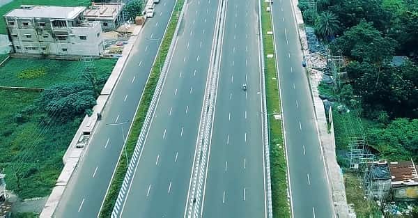
Barrackpore Kalyani Expressway Overview
| Detail | Information |
| Name | Kalyani Expressway (Barrackpore-Kalyani Expressway) |
| Maintained By | Kolkata Metropolitan Development Authority (KMDA) |
| Developed By | West Bengal Highway Development Corporation (WBHDC) |
| Length | Approx. 44.17 km (formal) to ~54 km (including full corridor) |
| Lanes | 4–6 lane tolled expressway (upgrade in progress) |
| South End | Nimta, North 24 Parganas (Belgharia Expressway / NH-19 Junction) |
| North End | Bansberia, Hooghly District |
| Key Towns on Route | Sodepur, Barrackpore, Kankinara, Naihati, Halisahar, Kanchrapara, Kalyani |
| Districts | Hooghly, Nadia, North 24 Parganas |
| Travel Time Reduction | 2 hours to 40 minutes (Kolkata–Kalyani) |
| Phase I Upgrade | 6-lane elevated connector Belgharia EW–Nimta to Muragacha (4.565 km, EPC) |
| Phase II Upgrade | Muragacha to Kampa widening |
| Alternative To | Barrackpore Trunk Road (BT Road) and Jessore Road |
| Connects To | Belgharia Expressway (NH-19); NH-12 at Barajaguli via SH-1 at Kalyani |
| Kalyani Significance | Planned satellite city; CSIR IICB; Kalyani University |
| State | West Bengal |
Route and Location
The expressway begins at Nimta — where it connects to the Belgharia Expressway that links to NH-19 and provides access to the Kolkata Airport zone — and runs northward parallel to the Hooghly River’s right bank through the dense industrial and residential townships of North 24 Parganas. Naihati, Halisahar, and Kanchrapara form the expressway’s central industrial zone — all three towns have significant engineering and manufacturing traditions. The expressway enters Kalyani — West Bengal’s planned satellite city — before continuing to Bansberia in Hooghly.
Connectivity
The Belgharia Expressway at the southern junction connects toward Kolkata’s airport and the NH-19 (former NH-2, Delhi-Kolkata highway) at Dankuni. SH-1 at Kalyani connects toward Bangaon and the Bangladesh border. NH-12 at Barajaguli connects toward North Bengal and the Northeast.
Nearby Areas
Barrackpore Cantonment — the historic British military cantonment that was one of the most strategically significant army posts in colonial Bengal and the site of the 1824 Mutiny by the 47th Native Infantry — is on the expressway corridor. Chandernagore (Chandannagar) in Hooghly — the former French colonial enclave with its preserved Strand promenade, French archives, and Indo-French heritage — is near the northern expressway zone. Kalyani University and the CSIR Institute of Immunochemistry and Biological (IICB) campus are the educational and research institutions that give Kalyani its planned-city character.
Frequently Asked Questions (FAQs)
Q1. What is the Barrackpore Kalyani Expressway?
A: A 44-km, 4 to 6-lane tolled expressway in West Bengal from Nimta (North 24 Parganas) to Bansberia (Hooghly), passing through Barrackpore, Naihati, Kanchrapara, and Kalyani. Maintained by KMDA.
Q2. How much travel time does the Kalyani Expressway save?
A: It reduces Kolkata-to-Kalyani travel from approximately 2 hours to 40 minutes — bypassing BT Road and Jessore Road congestion.
Q3. What upgrade is currently happening on the Kalyani Expressway?
A: Phase I widening to 6 lanes with a new elevated connector between Belgharia Expressway and the expressway from Nimta to Muragacha (4.565 km, EPC mode). Phase II covers Muragacha to Kampa.
Q4. What does Kalyani at the expressway’s north end offer?
A: A West Bengal planned satellite city housing Kalyani University, CSIR IICB research campus, residential sectors, and proximity to NH-12 for North Bengal connectivity.
Q5. What is the historic alternative road the Kalyani Expressway replaces?
A: The Barrackpore Trunk Road (BT Road) — India’s oldest metalled road, built 1775, running from Shyambazar to Barrackpore through continuous dense urban sprawl.