
The Chambal ravines have defined central India’s geography and imagination for centuries. The gullied badlands carved by the Chambal River across Rajasthan, Madhya Pradesh, and Uttar Pradesh were for decades the territory of dacoits and the stories told about them — a landscape of eroded canyons and forest scrub that resisted cultivation, settlement, and road-building alike. The Chambal runs for 960 kilometres before joining the Yamuna near Etawah, and the corridor alongside its middle course — through Kota, Sheopur, Morena, Gwalior, Bhind, and Etawah — has historically been one of the most infrastructure-deficient stretches of the Gangetic plains.
The Chambal Expressway, formally named the Atal Progress-Way (Atal Pragati Path) in honour of former Prime Minister Atal Bihari Vajpayee, is the most ambitious single infrastructure project ever planned for this terrain. Approved under the Bharatmala Pariyojana Phase I, the 404 to 420-kilometre, four-lane greenfield access-controlled expressway will connect Seemalya village in Kota district (Rajasthan) at the western end to Nanawa village in Etawah district (Uttar Pradesh) at the eastern end, running alongside the Chambal River through the states of Rajasthan, Madhya Pradesh, and Uttar Pradesh.
The Ministry of Road Transport and Highways granted in-principle approval to the Atal Progress-Way in January 2026, following a high-level review meeting chaired by Union Minister Nitin Gadkari. The revised alignment received approval after the original alignment was modified to bypass forest areas, wildlife habitats, and the sensitive Chambal ravines that made the earlier route environmentally untenable. Total estimated cost is approximately ₹14,000 crore, significantly revised from the earlier NHAI estimate of ₹23,645 crore due to the alignment changes. The expressway will run for approximately 309 km in Madhya Pradesh, 72 km in Rajasthan, and 23 to 78 km in Uttar Pradesh. At 120 km/h design speed, it reduces Kota-to-Etawah travel from 10 to 11 hours to 6 to 7 hours.
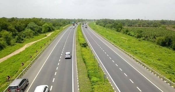
Chambal Expressway Overview
| Detail | Information |
| Official Name | Atal Progress-Way / Atal Pragati Path |
| Popular Name | Chambal Expressway |
| Named After | Former Prime Minister Atal Bihari Vajpayee |
| Maintained By | NHAI |
| Length | 404–420 km |
| Lanes | 4-lane (expandable to 6) |
| West End | Seemalya village, Kota District, Rajasthan |
| East End | Nanawa village, Etawah District, Uttar Pradesh |
| States | Rajasthan, Madhya Pradesh, Uttar Pradesh |
| MP Stretch | ~309 km |
| Rajasthan Stretch | ~72 km |
| UP Stretch | ~23–78 km |
| Estimated Cost | ~₹14,000 crore (revised) |
| Programme | Bharatmala Pariyojana Phase I |
| In-Principle Approval | January 6, 2026 (MoRTH) |
| Key Cities | Kota, Sheopur, Sabalgarh, Morena, Gwalior, Bhind, Etawah |
| Design Speed | 120 km/h |
| Travel Time (Kota–Etawah) | 6–7 hours (vs current 10–11 hours) |
| Connects To | Delhi-Mumbai Expressway (west); Agra-Lucknow / Bundelkhand Expressway (east) |
| Foundation Stone | September 2020 (CM Shivraj Singh Chauhan) |
| Completion Target | 2027 |
Route and Location
The expressway begins at Kota’s NH-27 interchange and runs eastward alongside the Chambal River through Sheopur and Sabalgarh before reaching the historic Chambal ravine zone near Morena and Bhind. Gwalior — Madhya Pradesh’s most historically significant northern city, seat of the Scindia dynasty and home to the imposing Gwalior Fort — is on the expressway’s route. At Etawah in UP, the expressway connects to the Agra-Lucknow Expressway and through it to the broader UP expressway network.
Connectivity
At Etawah, connection to the Agra-Lucknow Expressway provides direct access to Lucknow, Kanpur, and ultimately Delhi via the UP expressway chain. At Kota, the connection to NH-27 and the approaching Delhi-Mumbai Expressway makes the Chambal Expressway the bridge linking India’s longest expressway to the Bundelkhand and central Indian expressway network.
Nearby Areas
Ranthambore National Park — India’s most famous tiger reserve, in Rajasthan’s Sawai Madhopur district — is accessible from the expressway’s Rajasthan zone. The Chambal Wildlife Sanctuary along the river protects the critically endangered gharial (Gavialis gangeticus), the Indian skimmer, and the Gangetic river dolphin in one of India’s most ecologically significant freshwater habitats. Gwalior’s Jai Vilas Palace, Tansen’s tomb, and Scindia Museum make the city one of central India’s richest heritage destinations.
Frequently Asked Questions (FAQs)
Q1. What is the Chambal Expressway (Atal Progress-Way)?
A: A 404 to 420-km, four-lane greenfield expressway from Kota (Rajasthan) to Etawah (UP) through Madhya Pradesh, named after PM Atal Bihari Vajpayee. In-principle MoRTH approval received January 2026.
Q2. How much will the Chambal Expressway reduce travel time?
A: From 10 to 11 hours to 6 to 7 hours for the Kota-to-Etawah corridor — at a design speed of 120 km/h.
Q3. What expressways will the Chambal Expressway connect to?
A: The Delhi-Mumbai Expressway at the Rajasthan end, and the Agra-Lucknow Expressway and Bundelkhand Expressway at the UP end.
Q4. Why was the Chambal Expressway’s alignment revised?
A: The original alignment passed through forest areas, wildlife habitats, and environmentally sensitive Chambal ravines — it was revised to bypass these zones before receiving approval.
Q5. What wildlife sanctuary runs along the Chambal Expressway corridor?
A: The Chambal Wildlife Sanctuary — protecting the critically endangered gharial, Indian skimmer, and Gangetic river dolphin along the Chambal River.