For most of India’s modern history, the road from Mumbai to Delhi was a 24-hour endurance test — 1,424 kilometres of NH-48 (old NH-8) through Gujarati industrial towns, Rajasthan’s desert highway, and Haryana’s congested rural corridors, with trucks, level crossings, and the accumulated urban friction of a road that serves simultaneously as a national highway and every village’s main street. The Delhi-Mumbai Expressway proposes a 50 percent reduction in both distance and time — 1,242 kilometres at 120 km/h with no signals, no crossings, and 5G digital infrastructure managing traffic across six states.
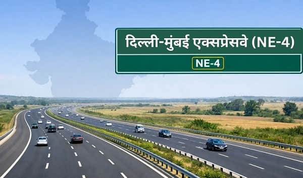
At 1,386 kilometres total including spurs, the Delhi-Mumbai Expressway is India’s longest expressway, designated National Expressway 4 (NE-4), built by NHAI at a total project cost of ₹1,00,000 crore (₹1 lakh crore). The Delhi end originates at two points: the DND Flyway at Maharani Bagh in Delhi, and the Sohna Elevated Corridor (21.65 km from Rajiv Chowk, Gurugram to Sohna). The Mumbai end terminates at two points: Virar in Palghar district and JNPT in Raigad district. Six states in between — Delhi (12 km), Haryana (129 km), Rajasthan (373 km), Madhya Pradesh (244 km), Gujarat (426 km), and Maharashtra (171 km) — are connected by this single corridor.
Key sections opened as of May 2026: Sohna-Dausa (February 2023), Dausa-Sawai Madhopur (October 2023), Vadodara-Bharuch (February 2024), Kota-Laban (December 2024), Bharuch-Kharel (January 2026), Vadodara-Godhra (April 2026). The expressway is approximately 82 to 94 percent complete with remaining work in select Gujarat-Maharashtra and the final Delhi sections.
Mumbai to Delhi Expressway Overview
| Detail | Information |
| Official Name | Delhi-Mumbai Expressway (National Expressway 4 / NE-4) |
| Maintained By | NHAI |
| Total Length | 1,386 km (including spurs) |
| Main Corridor | Sohna to Virar — 1,198 km |
| Lanes | 8-lane (expandable to 12) |
| North End | DND Flyway, Delhi; Sohna Elevated Corridor, Haryana |
| South End | Virar, Palghar (Maharashtra); JNPT, Raigad (Maharashtra) |
| States | Delhi, Haryana, Rajasthan, Madhya Pradesh, Gujarat, Maharashtra |
| Project Cost | ₹1,00,000 crore (₹1 lakh crore) |
| Design Speed | 120 km/h |
| Travel Time | ~12 hours Mumbai-Delhi (vs 24 hours on NH-48) |
| Distance Saving | 12% shorter — 1,424 km reduced to 1,242 km |
| Digital Features | 5G infrastructure; GPS-based tolling; AI traffic management |
| Safety Features | Helipads every 100 km; trauma centres every 100 km |
| Wildlife Features | Animal underpasses near Ranthambore; Mukundra wildlife crossings |
| Jaipur Spur | 67 km Bandikui-Jaipur connection |
| Jewar Airport Spur | 30 km to Noida International Airport |
| First Section Opened | Sohna-Dausa — February 12, 2023 |
| Overall Completion | ~82-94% (May 2026) |
Route and Location
The expressway’s main 1,198-kilometre Sohna-to-Virar corridor runs from Sohna southwestward through the Aravalli hill country of Haryana and Rajasthan, crosses the Chambal River on an iconic steel bridge in Madhya Pradesh, traverses the Malwa Plateau and Narmada valley before entering Gujarat at Dahod and reaching Vadodara, then continues along the Bharuch-Surat coastal industrial belt to Maharashtra’s western coast and terminating at Virar and JNPT.
Connectivity
At the Delhi end, the KMP Expressway (135.6 km) and the DND-Faridabad-KMP (59 km) provide orbital access. The Jaipur Spur (67 km) gives Rajasthan’s capital expressway connectivity. The Jewar Airport Spur (30 km) will connect to Noida International Airport. At Vadodara, the Baroda Expressway (NE-1) connects northward to Ahmedabad.
Nearby Areas
Ranthambore Tiger Reserve in Rajasthan’s Sawai Madhopur — India’s most visited tiger destination — is on the expressway’s Rajasthan section with dedicated wildlife underpasses. Shirpur in Gujarat and the Satpura Mountain zone in Madhya Pradesh are natural heritage zones along the route. Mumbai’s JNPT at the southern terminus is India’s largest container port.
Frequently Asked Questions (FAQs)
Q1. What is the Mumbai to Delhi Expressway?
A: NE-4, the Delhi-Mumbai Expressway — 1,386 km, India’s longest expressway, reducing Mumbai-Delhi travel from 24 hours to 12 hours. Total cost ₹1,00,000 crore.
Q2. How many states does the Mumbai-Delhi Expressway pass through?
A: Six — Delhi, Haryana, Rajasthan, Madhya Pradesh, Gujarat, and Maharashtra.
Q3. How much of the Mumbai-Delhi Expressway is open in 2026?
A: Approximately 82 to 94 percent — with multiple sections operational including Sohna-Dausa, Kota-Laban, Vadodara-Bharuch, and Vadodara-Godhra.
Q4. What are the unique digital features on the Mumbai-Delhi Expressway?
A: India’s first 5G digital highway — GPS-based tolling, AI traffic management, helipads every 100 km, and trauma centres every 100 km across the full 1,386-km corridor.
Q5. What spurs connect to the Mumbai-Delhi Expressway?
A: Jaipur Spur (67 km from Bandikui), Jewar Airport Spur (30 km to Noida International Airport), and the DND-Faridabad-KMP spur (59 km).