The Narmada River is Madhya Pradesh’s defining geographical and spiritual presence. Rising at Amarkantak in the Anuppur district of eastern MP — where the Maikal Hills meet the Satpura Range — it flows westward for 1,312 kilometres before reaching the Arabian Sea at Bharuch in Gujarat, passing through the marble gorges of Bhedaghat near Jabalpur, the Omkareshwar Jyotirlinga island in Khandwa, and the river’s sacred ghats that draw lakhs of pilgrims annually along its banks. Madhya Pradesh’s geography is, in many ways, the Narmada’s geography. The proposed Narmada Expressway mirrors this — an east-to-west greenfield corridor running parallel to the river’s course through the heart of the state.
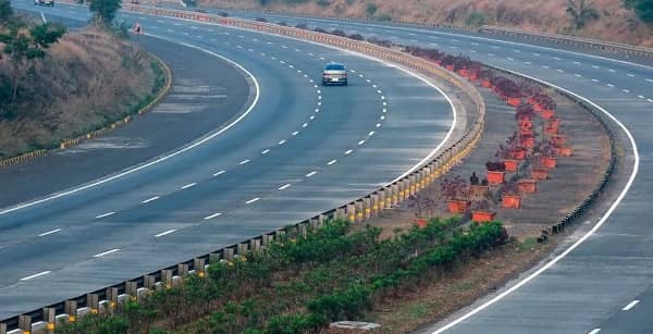
The Narmada Expressway, officially renamed Narmada Pragati Path, is a proposed six-lane access-controlled greenfield expressway connecting Amarkantak in eastern Madhya Pradesh to Alirajpur in the state’s western border zone with Gujarat. The Madhya Pradesh state cabinet sanctioned a 906-kilometre core stretch in February 2022. The full alignment under discussion extends to approximately 1,200 to 1,300 kilometres, which would make it four times the length of the Yamuna Expressway and one of the longest expressways in any single Indian state.
As of late 2025, the Narmada Expressway is in the pre-construction phase — the final Detailed Project Report (DPR) is being prepared and land acquisition has not yet commenced. Tenders and contracts have not been announced. The project is being developed by NHAI under the Bharatmala Pariyojana framework, with an initial cost estimate of approximately ₹30,000 crore for the first segments. The expressway will pass through 11 to 13 districts: Anuppur, Dindori, Mandla, Jabalpur, Narsinghpur, Hoshangabad (Narmadapuram), Harda, Khandwa, Khargone, Barwani, and Alirajpur — and will connect 30 national and state highways and district roads along its route.
Narmada Expressway Overview
| Detail | Information |
| Official Name | Narmada Expressway / Narmada Pragati Path |
| Maintained By | NHAI |
| Proposed Length | 906 km (cabinet-approved core) to 1,200–1,300 km (full alignment) |
| Lanes | 6-lane access-controlled greenfield |
| East End | Amarkantak, Anuppur District |
| West End | Alirajpur, MP–Gujarat Border Zone |
| State | Madhya Pradesh |
| Current Status | Pre-construction — DPR in preparation (late 2025) |
| Land Acquisition | Not yet commenced |
| Cabinet Approval | February 2022 (906-km core stretch) |
| Programme | Bharatmala Pariyojana |
| Estimated Cost | ~₹30,000 crore (initial segments) |
| Districts Covered | Anuppur, Dindori, Mandla, Jabalpur, Narsinghpur, Hoshangabad, Harda, Khandwa, Khargone, Barwani, Alirajpur |
| Highways Connected | 30 national highways, state highways, and district roads |
| Gujarat Extension | Future 150 km extension to Bharuch or Ahmedabad proposed |
| Scale Comparison | 4× the length of the Yamuna Expressway |
Route and Location
The expressway begins at Amarkantak — one of India’s most sacred pilgrimage sites, the source of the Narmada River and the Sone River at an altitude of approximately 1,065 metres on the Maikal Hills plateau. It runs westward broadly parallel to the Narmada River through Jabalpur, Narsinghpur, Hoshangabad, Harda, Khandwa, and Khargone before ending at Alirajpur on the Gujarat border. A future extension of approximately 150 kilometres to Bharuch or Ahmedabad in Gujarat would complete the corridor between Chhattisgarh and the Arabian Sea coast.
Connectivity
When operational, the Narmada Expressway will connect 30 national highways and state highways across Madhya Pradesh — the most comprehensive single-state highway integration project in the state’s infrastructure history. It will provide direct road links between Gujarat’s industrial and port economy and Chhattisgarh’s mineral economy through Madhya Pradesh’s agricultural and tourist heartland.
Nearby Areas
Bhedaghat — the Narmada River’s marble gorge near Jabalpur, where the river flows through white marble cliffs and the Dhuandhar waterfall creates a mist cloud visible from kilometres — is one of Madhya Pradesh’s most spectacular natural sites on this corridor. Omkareshwar, the island Jyotirlinga in Khandwa district where the Narmada bifurcates around a sacred island, is the spiritual centrepiece of the expressway’s western section. Amarkantak itself — combining the Narmada source with the Maikal Hills’ forest landscape — is an ecological and religious node of extraordinary significance.
Frequently Asked Questions (FAQs)
Q1. What is the Narmada Expressway?
A: A proposed six-lane greenfield expressway (Narmada Pragati Path) running 906 to 1,300 km across Madhya Pradesh from Amarkantak to Alirajpur, parallel to the Narmada River. Pre-construction stage, DPR in preparation as of late 2025.
Q2. When will the Narmada Expressway be completed?
A: The DPR is still being prepared as of late 2025, with land acquisition yet to begin. Construction timelines have not been formally confirmed.
Q3. Which districts does the Narmada Expressway pass through?
A: Eleven to thirteen — including Anuppur, Jabalpur, Narsinghpur, Hoshangabad, Harda, Khandwa, Khargone, Barwani, and Alirajpur.
Q4. How many national highways will the Narmada Expressway connect?
A: Approximately 30 national highways, state highways, and district roads across Madhya Pradesh.
Q5. Is there a Gujarat extension planned for the Narmada Expressway?
A: Yes — a 150-km future extension to Bharuch or Ahmedabad in Gujarat is proposed, which would create a seamless corridor between Chhattisgarh and Gujarat’s port economy.