
Uttar Pradesh has been building expressways with remarkable consistency for a decade — the Agra-Lucknow, Purvanchal, Bundelkhand, Gorakhpur Link, and Ganga Expressways have progressively stitched together different parts of the state’s vast geography. But a persistent connectivity gap remains: the diagonal corridor from Ghaziabad and the Delhi NCR fringe southward and eastward to Kanpur — two of the state’s most commercially significant cities — has no direct expressway. NH-91 connecting them is slow, crowded, and passes through dozens of populated urban fringes. The Ghaziabad-Kanpur Expressway proposes to change this.
The Ghaziabad-Kanpur Expressway is a 380-kilometre, four-lane greenfield access-controlled highway under planning by NHAI under the Green Highway Policy. It will connect Noida-Ghaziabad in the NCR’s eastern industrial zone to Kanpur — UP’s industrial capital — through nine districts of Uttar Pradesh: Ghaziabad, Hapur, Bulandshahr, Aligarh, Kasganj, Farrukhabad, Kannauj, Unnao, and Kanpur. Travel time from Ghaziabad to Kanpur will drop from the current 8 hours to approximately 5 to 5.5 hours. The four-lane initial design includes provisions for future expansion to six lanes as traffic demands grow.
The expressway is being developed as an eco-conscious greenfield project under NHAI’s Green Highway Policy — emphasising plantation of trees along the entire corridor, use of fly-ash and recycled materials in construction, and incorporation of industrial areas that benefit from the improved connectivity. Plans also include a 60-kilometre connector road from Hapur linking to the Meerut Expressway and NH-9 at Ghaziabad — extending the effective reach northward toward Meerut and the Delhi-Dehradun Expressway corridor. At the Kanpur end, the expressway connects directly to the Kanpur-Lucknow Expressway (NE-6) — creating an unbroken fast chain from Ghaziabad to Lucknow via Kanpur.
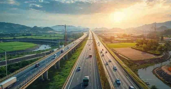
Ghaziabad Kanpur Expressway Overview
| Detail | Information |
| Name | Ghaziabad-Kanpur Expressway |
| Maintained By | NHAI (under Green Highway Policy) |
| Length | 380 km |
| Lanes | 4-lane (expandable to 6) |
| From | Ghaziabad / Noida, Uttar Pradesh |
| To | Kanpur, Uttar Pradesh |
| Type | Greenfield access-controlled expressway |
| Districts Covered | Ghaziabad, Hapur, Bulandshahr, Aligarh, Kasganj, Farrukhabad, Kannauj, Unnao, Kanpur |
| Travel Time Reduction | 8 hours → 5 hours (Ghaziabad–Kanpur) |
| Hapur Connector | 60 km connector road joining Meerut Expressway and NH-9 at Ghaziabad |
| Jewar Airport Link | Plans to connect to Noida International Airport at Jewar via extension |
| Southern Connection | Connects to Kanpur-Lucknow Expressway (NE-6) at Kanpur |
| Northern Connection | Connects to National Highway 9 |
| Current Status | Planning/design stage — DPR in preparation (2025) |
| Green Highway Policy | Tree plantation corridor; recycled materials; eco-infrastructure |
| State | Uttar Pradesh |
Route and Location
The expressway begins in the Ghaziabad-Noida corridor — the NCR’s eastern industrial and logistics zone — and runs southward through the Doab region between the Ganges and Yamuna rivers, passing through Hapur, Bulandshahr, and Aligarh before crossing eastward through Kasganj, Farrukhabad, and Kannauj, and eventually reaching Unnao and Kanpur. The route through the Doab traverses one of India’s most densely agricultural landscapes — sugarcane and wheat cultivation defining the visual character of this central UP corridor.
Connectivity
NH-9 at the Ghaziabad end connects toward Punjab’s Fazilka and Uttarakhand’s Pithoragarh — making the expressway an indirect boost to the Punjab-UP-Uttarakhand national connectivity. At Kanpur, the NE-6 Kanpur-Lucknow Expressway (expected to open March 2026) provides the onward fast connection to Lucknow. The planned Jewar Airport connection positions the expressway as part of the NCR aviation-to-UP interior connectivity chain.
Nearby Areas
Aligarh — home to Aligarh Muslim University (one of India’s most historically significant universities founded 1875) and the city famous for its lock-making industry — is one of the corridor’s most significant urban nodes. Kannauj, the perfume capital of India where the ancient art of attar distillation has been practised for centuries, sits on the expressway’s middle section. Farrukhabad is a historic Nawabi trading town whose textile and potato farming economy will directly benefit from improved logistics access.
Frequently Asked Questions (FAQs)
Q1. What is the Ghaziabad Kanpur Expressway?
A: A planned 380-km, four-lane greenfield expressway under NHAI’s Green Highway Policy connecting Ghaziabad/Noida to Kanpur through 9 UP districts. Currently in DPR/planning stage.
Q2. How much will the Ghaziabad Kanpur Expressway reduce travel time?
A: From approximately 8 hours to 5 hours — saving around 3 hours on the Ghaziabad-Kanpur journey.
Q3. Which districts does the Ghaziabad Kanpur Expressway pass through?
A: Ghaziabad, Hapur, Bulandshahr, Aligarh, Kasganj, Farrukhabad, Kannauj, Unnao, and Kanpur — nine districts of Uttar Pradesh.
Q4. How does the Ghaziabad Kanpur Expressway connect to Lucknow?
A: It connects at Kanpur to the NE-6 Kanpur-Lucknow Expressway (Awadh Expressway) — creating a chain from Ghaziabad to Kanpur to Lucknow on expressway-standard roads.
Q5. What is the Green Highway Policy connection to this expressway?
A: NHAI’s Green Highway Policy mandates eco-friendly construction — tree plantation along the full 380-km corridor, use of fly-ash and recycled materials, and sustainability features integrated into the expressway’s design from inception.