Mumbai’s eastern corridor has always carried a traffic burden that the western suburbs, for all their congestion, rarely match in industrial intensity. The Sion-Panvel Highway — widely called the Sion-Panvel Expressway given its multi-lane, high-capacity character — is the primary arterial that stitches together the eastern Mumbai belt with the planned cities of Navi Mumbai and the Panvel gateway toward the Mumbai-Pune Expressway and beyond. Without this road, the daily movement of freight from JNPT, the industrial workforce of the Thane-Belapur Road belt, and the residential commuters of Navi Mumbai’s planned sectors would have no efficient corridor to operate through.
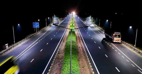
The highway runs 25 kilometres from Sion in Central Mumbai to the Kalamboli junction near Panvel, passing through Chembur, Mankhurd, the Vashi bridge crossing of Thane Creek, and the major Navi Mumbai nodes of Sanpada, Nerul, Belapur, Kharghar, and Kamothe. A widening project completed in 2014 expanded the road to 10 lanes — five in each direction — adding three new flyovers at Uran Junction, Sanpada Junction, and Kamothe Junction to provide grade-separated movement through the most congested crossing points. The highway is fully operational and has been so for several years under the joint management of PWD, MCGM, and MSRDC.
| Detail | Information |
| Name | Sion-Panvel Highway / Sion-Panvel Expressway |
| Current Status | Fully Operational |
| Location | Eastern Mumbai to Panvel, Maharashtra |
| Route | Sion (BARC Junction), Mumbai → Kalamboli Junction, Panvel (Mumbai-Pune Expressway) |
| Key Areas Passed | Chembur, Mankhurd, Vashi, Sanpada, Nerul, CBD Belapur, Kharghar, Kamothe, Kalamboli |
| Total Length | 25 km |
| Lanes | 10 lanes (5 in each direction) |
| Speed Limit | 70 km/h |
| Toll Fee (Cars) | ₹40 one-way |
| Toll Fee (Trucks/Buses) | ₹130 one-way |
| Toll Plazas | 2 plazas (primary plaza at Vashi) |
| Key Bridges | Thane Creek Bridge (TCB), TCB II, TCB III |
| Flyovers | Uran Junction, Sanpada Junction, Kamothe Junction |
| Project Cost | Approx. ₹1,220 crore |
| Governing Authority | PWD Maharashtra, MCGM, MSRDC |
| Key Connections | Eastern Express Highway (Sion), Mumbai-Pune Expressway (Kalamboli) |
Route and Location
The expressway begins at the BARC Junction in Sion — where it connects to the Eastern Express Highway coming up from South Mumbai — and runs eastward and southward across the Thane Creek via the Thane Creek Bridges before entering Navi Mumbai’s planned city grid. The three Thane Creek bridge crossings are the expressway’s most distinctive engineering features — massive bridges spanning the brackish creek that separates Mumbai island from the mainland — and they carry the dual function of traffic corridor and ecological boundary marker between the urban densities on either side.
After the creek crossing at Vashi, the road passes through Navi Mumbai’s major planned nodes in a sequence that reflects CIDCO’s original township planning — Sanpada, Nerul, Belapur, Kharghar, Kamothe — before terminating at Kalamboli where the Mumbai-Pune Expressway begins its climb toward the ghats.
Speed Limits and Toll
The 70 km/h speed limit is considerably lower than the open expressway speeds of longer inter-city corridors, reflecting the urban highway character of a road that passes through densely populated Navi Mumbai with multiple entry and exit points, pedestrian underpasses, and the inherent complexity of a multi-node urban arterial. The toll of ₹40 one-way for cars is modest by Mumbai infrastructure standards, collected at the Vashi toll plaza through FASTag and cash facilities.
Nearby Areas
JNPT and Container Traffic: Jawaharlal Nehru Port Trust — India’s busiest container port — generates enormous freight traffic toward the expressway via the Uran Road connector, making this highway critical for the national logistics economy beyond its commuter function. Navi Mumbai Airport Zone: The upcoming Navi Mumbai International Airport development near Ulwe is directly accessible from the expressway corridor, adding a significant future traffic dimension to this already heavily used arterial. CBD Belapur: Navi Mumbai’s central business district with its corporate offices and Harbour Line railway terminus is a major destination node along the expressway’s southern section.
Frequently Asked Questions (FAQs)
Q1. What is the Sion Panvel Expressway and where is it?
A: A 25 km, 10-lane highway connecting Sion in Mumbai to Kalamboli near Panvel, passing through Navi Mumbai’s major nodes. Fully operational.
Q2. What is the toll fee on Sion Panvel Expressway?
A: ₹40 one-way for cars; ₹130 for trucks and buses. Main toll plaza is at Vashi.
Q3. What is the speed limit on Sion Panvel Highway?
A: 70 km/h, reflecting its urban highway character through the densely populated Navi Mumbai corridor.
Q4. How many lanes does Sion Panvel Expressway have?
A: 10 lanes — five in each direction — following the 2014 widening project.
Q5. Where does Sion Panvel Expressway connect at its southern end?
A: At Kalamboli junction near Panvel, directly connecting to the Mumbai-Pune Expressway.