
The Bengaluru-Mysuru Expressway has a complicated naming history that reflects the complicated history of the corridor itself. The NICE Road — Nandi Infrastructure Corridor Enterprise — was originally conceived to build a private expressway connecting Bangalore and Mysore through a BOT model. That project eventually ran into insurmountable land acquisition and financial difficulties and was cancelled. In its place, the NHAI developed NH-275 as a national highway upgrade combining 60 percent brownfield improvements to the existing state highway with 40 percent greenfield alignment. Prime Minister Narendra Modi inaugurated the result on March 12, 2023, and the corridor that once generated years of legal and political controversy is now one of Karnataka’s most successfully operational pieces of road infrastructure.
The numbers justify the project clearly. A journey between Bengaluru and Mysuru that regularly took three hours on the old SH-17 now takes approximately 90 minutes to two and a half hours on the expressway. The 119-kilometre corridor passes through some of Karnataka’s most historically and commercially important territory — the Ramanagara gorge country, the silk-producing towns of Channapatna and Maddur, the culturally rich Mandya district, and the outskirts of Srirangapatna before entering Mysuru city. Tourism to Mysuru has increased noticeably since the expressway opened, and the Channapatna toy-making and silk industries have seen improved market access to Bengaluru’s enormous consumer base.
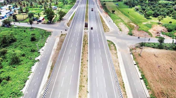
Current Status: Fully Operational since March 12, 2023. Inaugurated by PM Narendra Modi.
Overview Table
| Detail | Information |
| Name | Bengaluru-Mysuru Expressway (NH-275) |
| Also Known As | Bangalore-Mysore Expressway; formerly associated with NICE corridor |
| Current Status | Fully Operational since March 12, 2023 |
| Location | Karnataka — Bengaluru to Mysuru |
| Route | Panchamukhi Ganapathi Temple, NICE Road, Bengaluru → Naguvanahalli, Mysuru |
| Total Length | 119 km |
| Phase 1 | Bengaluru to Nidaghatta — 58 km |
| Phase 2 | Nidaghatta to Mysuru — 61 km |
| Lanes | 6 to 10 lanes |
| Speed Limit | 100 km/h (cars); 80 km/h (heavy vehicles) |
| Toll Fee — Cars (Full Journey) | ₹320 one-way; ₹485 round trip within 24 hours |
| Toll Fee — Cars (Bengaluru to Nidaghatta) | ₹170 one-way; ₹255 round trip |
| Toll Fee — Cars (Nidaghatta to Mysuru) | ₹160 one-way; ₹240 round trip |
| Monthly Pass (Cars) | ₹5,185 |
| Two-Wheelers | Not permitted on expressway; service road available |
| Toll Collection | FASTag enabled |
| Governing Authority | NHAI under Bharatmala Pariyojana |
| Project Cost | Approx. ₹8,480 crore |
| Travel Time | Approximately 90 minutes to 2.5 hours (versus 3 hours earlier) |
Route and Location
The expressway begins at the Panchamukhi Ganapathi Temple junction on NICE Road in southwestern Bengaluru — the connection point that links the new expressway to the NICE Ring Road’s existing infrastructure. Running southwestward, it passes through Ramanagara — the rocky gorge district made famous as the filming location of the original Sholay — and continues through the Channapatna silk and toy-making town, the Maddur agricultural market zone, Mandya’s sugar belt, the Srirangapatna historical island near Mysuru, and terminates at Naguvanahalli on the western approach to Mysuru city.
Phase 1 runs from the Bengaluru starting point to the Nidaghatta interchange approximately 58 kilometres in — roughly the midpoint of the expressway. Phase 2 covers the remaining 61 kilometres through to Mysuru. Two toll plazas are positioned at Ganaguru (serving Phase 1) and at a second plaza covering the Phase 2 approach.
Speed Limits and Toll
The speed limit of 100 km/h rather than the usual 120 km/h for expressways reflects the corridor’s partly urban-suburban character, particularly near the Bengaluru entry zone, and the presence of the service road alongside which carries two-wheelers at normal highway speeds. The ₹320 full-journey one-way toll for cars — revised upward from ₹165 in the first revision cycle — represents a per-kilometre cost that is competitive with comparable Karnataka road infrastructure.
Nearby Areas
Ramanagara: The rocky volcanic hills of Ramanagara district, made internationally famous as the Sholay filming location, are directly accessible from the expressway’s northern section and have become a weekend day-trip destination for Bengaluru’s enormous professional residential population. Channapatna: The silk and wooden toy manufacturing town whose craft traditions are Geographical Indication-protected has seen improved market access to Bengaluru’s consumer base since the expressway opened. Brindavan Gardens and Srirangapatna: The historic island fortress of Tipu Sultan and the spectacular Krishnaraja Sagara dam and Brindavan Gardens near Mysuru’s western approach are accessible from the expressway’s terminal zone, making the corridor a practical heritage and tourism corridor of genuine significance.
Frequently Asked Questions (FAQs)
Q1. What is the Bengaluru-Mysuru Expressway and when did it open?
A 119 km national highway (NH-275) connecting Bengaluru to Mysuru, inaugurated on March 12, 2023 by PM Modi. Fully operational.
Q2. What is the toll fee on Bangalore Mysore Expressway?
₹320 one-way for cars doing the full journey; ₹485 round trip. Phase-wise tolls: ₹170 (Bengaluru to Nidaghatta) and ₹160 (Nidaghatta to Mysuru).
Q3. What is the speed limit on Bangalore Mysore Expressway?
100 km/h for cars — slightly lower than standard expressway speeds due to the corridor’s partly suburban character.
Q4. Are two-wheelers allowed on Bangalore Mysore Expressway?
No — two-wheelers are not permitted on the expressway itself but can use the parallel service road that runs alongside most of the route.
Q5. How much time does the expressway save between Bengaluru and Mysuru?
The journey now takes approximately 90 minutes to 2.5 hours compared to 3 hours on the old highway — a meaningful saving, especially for weekend and tourism traffic.