
Across the Thar Desert, through the camel-dotted sandscape of western Rajasthan, between the Beas River plains of Punjab and the oil refinery towers of Gujarat’s Saurashtra coast — the Amritsar-Jamnagar Expressway is a journey through North India’s most geographically dramatic interior. This 1,257-kilometre six-lane access-controlled expressway, also known as NH-754, connects Amritsar in Punjab to Jamnagar in Gujarat across four states, forming India’s second-longest expressway behind only the Delhi-Mumbai Expressway.
The project is being developed by NHAI under the Bharatmala Pariyojana. The Hanumangarh-to-Jalore section in Rajasthan was the first to open on July 8, 2023, when Prime Minister Narendra Modi inaugurated the stretch. Approximately 85 percent of total construction work was completed by mid-2025, with the December 2025 full completion target representing the project’s latest revised milestone. The expressway reduces the Amritsar-to-Jamnagar road distance from 1,516 kilometres to approximately 1,300 kilometres, and cuts travel time from 26 hours to approximately 13 hours.
Roughly 650 kilometres of this corridor cuts through Rajasthan — the longest single-state stretch — passing over vast sections of the Thar Desert where sand dunes flank the highway for hundreds of kilometres, making this one of India’s most visually distinctive expressway drives. The expressway infrastructure includes 5 railway overbridges, 20 river overbridges, 26 interchanges, 55 underpasses, and 311 smaller underpasses. Electric vehicle charging stations are planned every 20 to 30 kilometres along the route, reflecting the modern sustainability standards embedded in the project design.
The Amritsar-Jamnagar Expressway is also strategically linked to the Delhi-Amritsar-Katra Expressway at the Punjab end, creating a continuous high-speed corridor from Kashmir-bound traffic all the way to Gujarat’s refinery coast. Its alignment close to the India-Pakistan border in Rajasthan adds a significant defence and logistics dimension beyond civilian mobility.
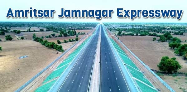
Jamnagar Amritsar Expressway Overview
| Detail | Information |
| Official Name | Amritsar-Jamnagar Expressway / Amritsar-Jamnagar Economic Corridor |
| Highway Number | NH-754 |
| Maintained By | NHAI |
| Length | 1,257 km |
| Lanes | 6-lane (expandable to 8) |
| North End | Tibba, Kapurthala, Punjab |
| South End | Jamnagar, Gujarat |
| States Covered | Punjab, Haryana, Rajasthan, Gujarat |
| Key Cities | Amritsar, Bathinda, Moga, Mandi Dabwali, Hanumangarh, Suratgarh, Bikaner, Nagaur, Jodhpur, Barmer, Jamnagar |
| Programme | Bharatmala Pariyojana |
| First Section Open | July 8, 2023 (Hanumangarh–Jalore, Rajasthan) |
| Full Completion Target | December 2025 |
| Construction Progress | Approx. 85% complete (2025) |
| Travel Time Reduction | 26 hours to 13 hours |
| Distance Reduction | 1,516 km to ~1,300 km (saving ~216 km) |
| Rajasthan Stretch | Approx. 650 km — longest single-state section |
| Infrastructure | 5 railway overbridges, 20 river overbridges, 26 interchanges, 55 underpasses |
| EV Charging | Every 20–30 km along route |
| Connects To | Delhi-Amritsar-Katra Expressway; Ludhiana-Bathinda-Ajmer Expressway |
| India Rank | Second-longest expressway in India |
Route and Location
The expressway begins at Tibba in Kapurthala district, Punjab, runs southward through Bathinda’s oil and gas industrial zone and into Haryana’s Mandi Dabwali before entering Rajasthan at Hanumangarh. It crosses the Rajasthan desert through Suratgarh, Bikaner, Nagaur, and Jodhpur before descending to Barmer near the Pakistan border and crossing into Gujarat toward Jamnagar.
Connectivity
The connection to the Delhi-Amritsar-Katra Expressway at the Amritsar-Kapurthala junction creates a continuous national corridor from Kashmir toward Gujarat. The Ludhiana-Bathinda-Ajmer Expressway connects via the Bathinda interchange. At Jamnagar, the corridor connects to the Kandla Port and JNPT logistics network via Gujarat’s coastal highway system. Oil refineries at Jamnagar (Reliance), Barmer, and Bathinda — the three nodes this expressway was originally designed around — will benefit from dramatically reduced crude and product logistics costs.
Nearby Areas
The Golden Temple in Amritsar, India’s most visited religious site at the Punjab terminus, positions this expressway as a pilgrimage-tourism corridor at its northern end. Bikaner’s Junagarh Fort and the camel research station, Jodhpur’s Mehrangarh Fort and the Blue City, and Barmer’s traditional handicrafts are the cultural landmarks along the Rajasthan desert stretch.
Frequently Asked Questions (FAQs)
Q1. What is the Jamnagar Amritsar Expressway?
A: NH-754, a 1,257 km, six-lane expressway connecting Amritsar (Punjab) to Jamnagar (Gujarat) across Punjab, Haryana, Rajasthan, and Gujarat. India’s second-longest expressway.
Q2. When will the Amritsar Jamnagar Expressway be fully complete?
A: December 2025 — with approximately 85% construction completed by mid-2025 and multiple sections already operational.
Q3. How much does the Amritsar Jamnagar Expressway reduce travel time?
A: From 26 hours to 13 hours — cutting the journey time by approximately half.
Q4. Which section of the Amritsar Jamnagar Expressway opened first?
A: The Hanumangarh-to-Jalore section in Rajasthan, inaugurated by PM Modi on July 8, 2023.
Q5. Why is this expressway strategically significant for defence?
A: Its alignment runs close to the India-Pakistan border in Rajasthan, making it a critical logistics and defence mobility corridor for the western border regions.