
Patna’s road infrastructure story in the 2020s is one of the most dramatic urban transformation narratives in any Indian state capital. A city that for decades tolerated potholed arterials, single-lane bridges, and traffic jams stretching across the Ashok Rajpath spine has, over a ₹9,200 crore programme of road projects, been rebuilt with flyovers, elevated corridors, and expressways that have permanently changed how Patna’s residents move through their city. Atal Path was the first of these ambitious projects to be inaugurated — by Chief Minister Nitish Kumar in January 2021, with work having begun in 2019.
Atal Path is a 6.3-kilometre six-lane road connecting R-Block to Digha in Patna, named after former Prime Minister Atal Bihari Vajpayee. The road’s geographic purpose is precise and practical — it provides a north-south spine through the administrative heart of Patna, connecting the R-Block government complex and Secretariat zone in the city’s southern administrative belt to the Digha neighborhood on the Ganga’s southern bank, from where the JP Setu bridge crosses to Sonepur in Vaishali district and the Loknayak Ganga Path continues eastward toward Deedarganj.
People travelling from Gandhi Maidan to important government areas such as R-Block, the Secretariat, and the Legislative Assembly can now use Atal Path, avoiding the heavy congestion at Dak Bungalow crossing and the Income Tax roundabout. Vehicles coming from areas such as Kankarbagh can directly reach JP Setu through Atal Path, Chiraiyatand bridge, and the Mithapur flyover. The speed limit on the road is 80 kilometres per hour — a figure that would have sounded implausible for central Patna roads before this infrastructure generation.
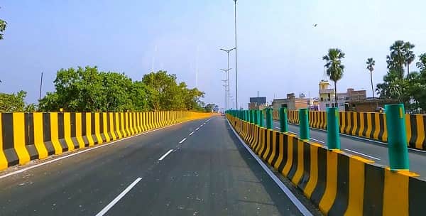
Atal Path Expressway Overview
| Detail | Information |
| Name | Atal Path Expressway (Atal Path) |
| Named After | Former Prime Minister Atal Bihari Vajpayee |
| Location | Patna, Bihar |
| Route | R-Block to Digha (north-south corridor) |
| Length | 6.3–6.5 km |
| Lanes | 6-lane |
| Inaugurated | January 2021 |
| Inaugurated By | Chief Minister Nitish Kumar |
| Construction Started | 2019 |
| Speed Limit | 80 km/h |
| Connects To | JP Ganga Path (Loknayak Ganga Path); JP Setu bridge; Ashok Rajpath |
| Congestion Relief | Bypasses Dak Bungalow crossing and Income Tax Roundabout |
| Government Zone Access | R-Block, Bihar Secretariat, Bihar Legislative Assembly |
| Part of | Patna ₹9,200 crore urban road infrastructure programme |
| Also Connects | Kankarbagh-JP Setu route via Chiraiyatand and Mithapur flyover |
| State | Bihar |
Route and Location
Atal Path runs from R-Block — the administrative complex housing the Bihar Secretariat and Legislative Assembly — northward to Digha, one of Patna’s western riverside neighborhoods and the northern bank terminus of the Atal Path corridor. The alignment passes through one of the most institutionally significant parts of the capital city, flanked by government buildings, college campuses, and the commercial districts that serve the administrative population. The road connects at its northern end to the Digha zone, where the JP Ganga Path begins its eastward riverfront journey toward Deedarganj.
Connectivity
Atal Path and Ashok Rajpath are connected to the Loknayak Ganga Path via approach lanes, with plans to link Atal Path more directly to ease access between AIIMS Patna and PMCH. A journey that previously took an hour between these two hospitals can now be completed in approximately 20 minutes. The JP Ganga Path — completed through multiple phases from June 2022 to April 2025 — forms the east-west companion corridor to Atal Path’s north-south alignment, with both roads together radically reducing travel times across Patna’s most congested central belt.
Nearby Areas
Bihar Secretariat and Legislative Assembly: The core of Bihar’s state government administration is directly accessible from Atal Path’s southern R-Block terminus — the government employee population is among the road’s primary daily users. Golghar: Patna’s iconic granary built by Captain John Garstin in 1786 is near the Ganga Path junction accessible from Atal Path’s northern end. JP Setu (Jai Prakash Narayan Bridge): The bridge crossing the Ganga from Digha to Sonepur in Vaishali — the longest road-cum-rail bridge in Asia when built — connects Atal Path’s northern terminus to North Bihar.
Frequently Asked Questions (FAQs)
Q1. What is Atal Path Expressway in Patna?
A: A 6.3 km six-lane urban road in Patna connecting R-Block to Digha, named after former PM Atal Bihari Vajpayee. Inaugurated January 2021 by CM Nitish Kumar.
Q2. What congestion does Atal Path relieve in Patna?
A: It bypasses the heavily congested Dak Bungalow crossing and Income Tax Roundabout, allowing direct access between the Secretariat, R-Block, and Digha without navigating central Patna.
Q3. What is Atal Path’s speed limit?
A: 80 km/h — unusually high for a central city road, made possible by its access-controlled design.
Q4. What other roads connect to Atal Path?
A: The JP Ganga Path (Loknayak Ganga Path / Patna Marine Drive), JP Setu bridge, Chiraiyatand bridge, and Mithapur flyover.
Q5. What is the Patna urban road programme that includes Atal Path?
A: A ₹9,200 crore road transformation programme including JP Ganga Path (20.5 km), Lohia Path Chakra, Danapur-Bihta Elevated Road, and multiple flyovers and elevated corridors across Patna.